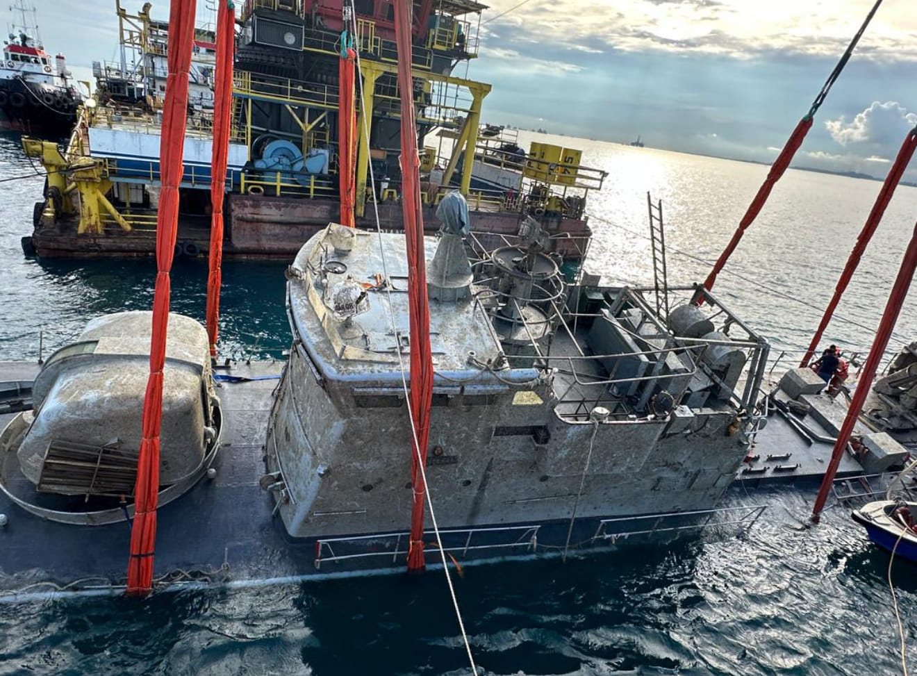
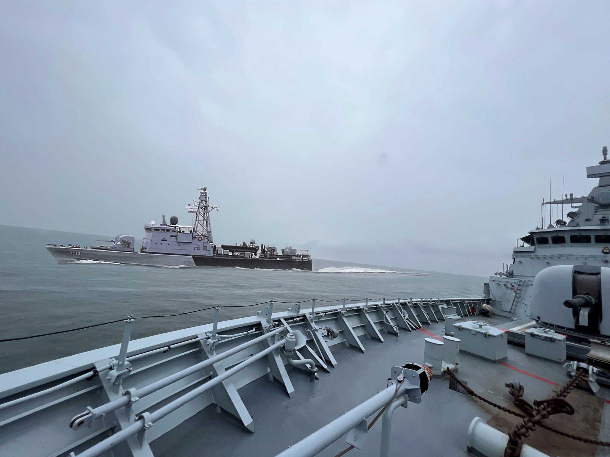
SHAH ALAM: RMN investigation into the sinking of KD Pendekar found that navigational error led the Handalan-class FAC to sail on to a well charted reef. And once the ship’s hull was breached, her old age meant that efforts to save her were futile.
The board also found that strong currents and low visibility as the main factors that led to the drowning of a navy diver tasked with the initial salvage work on the wreck.
In a statement released last night, RMN said the investigation board found two main factors in the Pendekar incident. The first was that the FAC deviated from it planned route which resulted in the collision with Stork Reef (Terumbu Punggai) on August 25. It did not say however why pennant number 3513 deviated from its planned route and instead sailed directly to or over the reef which resulted in the breach of the hull.
Her old age directly led to her sinking. The 45-year-old hull was weak and once it was breached (following the collision with the reef) caused difficulties in the damage control efforts and led to the quick flooding of other compartments. (It was the flooding of the other compartments which likely led to her commanding officer ordering the crew to abandon the ship). She sank four hours after running over the reef.


The release also said the local company hired for the salvage operations for Pendekar completed its work on October 15. The wreck was refloated three days earlier. The wreck is now moored at Tanjung Belungkor, near Penggerang.


The board also found that strong currents and limited visibility as the main factors leading to the death of a navy diver during the Pendekar’s salvage operation on August 28.
It said Leading Seaman 1 Arman San Hermansa’s safety line became entangled with the ship, which made it impossible for him to alert the others of his predicament. As a result, emergency procedures were not implemented which led to his drowning.
“The investigations indicated that diving SOPs and safety measures were followed prior to the dive. The diving equipment was functional before and after the operation, and the diver was confirmed to be certified,” it said.
Based on the report, I believe Pendekar will be struck from RMN roll of active ships.
–Malaysian Defence
If you like this post, buy me an espresso. Paypal Payment
View Comments (16)
Hope the navy cannibalize any working part and equipment and turn the ship into coral reef. It will be extremely wild if the their decided to keep the ship alive at this point.
I dont think there is any working part on the ship already. It had sunk and was only recovered about 60 days later.
"So what is that mysterious underwater object? A reef? A wreck? A conning tower of a unsub?"
So I was right that it was something identifiable and others had pooh poohed a reef. Worse it was a well known reef. So isnt this error that led to the sinking something to be learnt? The investigation needs to drill further down; was it human error in navigation? Was it blown off course and not realised? It seems that boat had sat nav so unlikely for it to not alert a charted reef, so was it malfunction?
Thats why I said there is a lesson to be learned or else we would repeat such stupid mistake.
Questions will have to be asked with the NO made the nav error and why it was not detected. No idea if the CO was on the bridge though. Another issue with being in the Straits of Melaka and Singapore is the heavy traffic. A collision can easily occur.
"others had pooh poohed a reef"
Nobody "pooh poohed" anuthung; only rhdt reefs don't move and that the route was a well used and surveyed one. We didn't know at that time there was a nav error.
"Thats why I said there is a lesson to be learned or else we would repeat such stupid mistake."
And why I said there's a lesson to be leant from every single incident.
Human error. Makes one wonder the quality of the training for the officers. Lucky it was a small 45 yr old boat. Internal investigation found the boat deviated from its course. What’s the purpose of million dollar equipment if they can’t even avoid a well known reef. Blunder
Other countries also had this kind of error
Qamarul,
In many areas the quality has dropped and it's a problem well understood by the service.
Qamarul - 'What’s the purpose of million dollar equipment if they can’t even avoid a well known reef"
You do understand that they did not know they were off route; hence were not expecting a reef.
"And why I said there’s a lesson to be leant from every single incident."
No you didnt. Isnt this what you said; "What lesson would that be?" "Unlikely it was a reef as reefs don’t move" "Possibly a log."
Other nations ships have ran aground before but afaik not onto known reefs. Those who forget their history are condemned to repeat it, if one never learns or think there is nothing to learn.
Azlan-You do understand that they did not know they were off route; hence were not expecting a reef
The ship got radar? Also even for smaller boat the radar also come equipped with chart plotting aid (ARPA). The helmsman also should know the ship current heading and bearing etc etc. To simply said they “did not know they were off course) is alien to me. These are not tongkangs. I cannot brain it. These ships are property of the people and it should be treated as such. We need to know more.
Nav radar do not show underwater reefs. Charts do.
@Qamarul
"Makes one wonder the quality of the training for the officers."
If theres sat nav even a fool knows how to use Google Maps/Waze. While its true young Msians competence have dropped, technology has evolved to take a lot of that thinking process. They are also more tech savvy than me old fart.
"Nav radar do not show underwater reefs. Charts do."
Iirc, sat nav should able to indicate known objects & obstacles. Seen arctic trawler documentary that they could sat navigate thru shoals & identified icebergs. Also super yachts have sat nav that allows it to anchor very close to known reefs for scuba diving/shore landings.
"You do understand that they did not know they were off route"
Unless the ship lost sat contact, sat nav GPS should still able to guide even if lost position. Of course provided it has sat nav.